
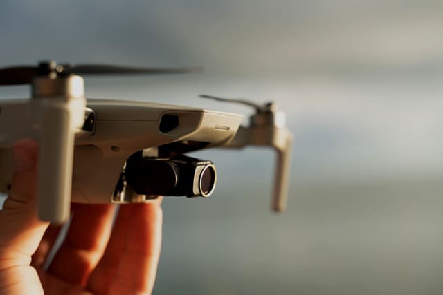
Drones are rapidly changing the way real estate professionals approach property inspections, listing preparation, and property marketing. For real estate agents, drone technology can provide aerial perspectives that are difficult, expensive, or potentially dangerous to obtain using traditional inspection methods. High-resolution cameras can capture roofs, gutters, exterior structures, large lots, and hard-to-reach areas from multiple angles. This information can help agents identify potential concerns earlier and give buyers a more complete visual understanding of a property. As drone technology becomes more accessible, understanding how drones are changing property inspections can help real estate agents stay competitive while improving the quality of property information they provide.
Improved Safety for Property Professionals
Safety is another important reason drones are changing property inspections. Roofs, steep slopes, tall structures, and expansive properties can create situations where accessing certain areas presents unnecessary risks. Using a drone for an initial visual assessment can allow professionals to examine these locations from a safer position on the ground. This can reduce the need for repeated climbing or difficult access during preliminary property evaluations. Real estate agents can also use drone imagery to communicate visible exterior concerns to inspectors, contractors, sellers, and other professionals before additional work is scheduled. By making certain inspections less dependent on physical access, drones can contribute to safer and more efficient real estate workflows.
Better Documentation of Property Conditions
High-quality drone photography can create a useful visual record of a property’s exterior condition. Images captured from consistent angles can document roofs, outbuildings, landscaping, retaining walls, driveways, fencing, pools, and other features that may be difficult to appreciate from street-level photographs. This documentation can be especially helpful for large estates, rural properties, commercial buildings, and homes with extensive acreage. Agents can maintain relevant imagery as part of their broader property documentation while remaining mindful of privacy and applicable disclosure requirements. Detailed aerial records can also make it easier to compare visible exterior conditions over time, particularly when properties experience severe weather or undergo significant improvements.
Faster Roof and Exterior Inspections
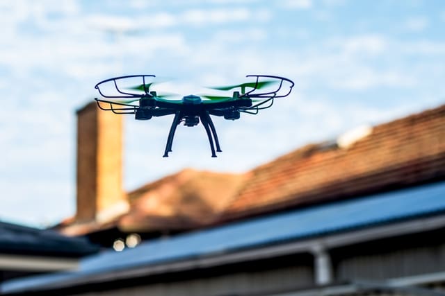
One of the most practical applications of drones in real estate is inspecting areas that are difficult to reach from the ground. A drone equipped with a high-resolution camera can capture detailed images of roofs, chimneys, gutters, siding, solar panels, and other exterior features without requiring someone to immediately climb onto the structure. This aerial perspective can help identify visible issues such as damaged shingles, missing materials, clogged gutters, storm damage, or areas of deterioration. For agents, faster visual assessments can be particularly useful when preparing a property for market or documenting a home’s condition. Although drone imagery does not replace a professional property inspection, it can provide valuable supplemental information and help determine whether closer examination may be warranted.
Aerial Technology Helps Inspect Large Properties
Large properties present unique challenges because walking the entire site can take considerable time. Drones can cover substantial areas quickly while collecting aerial images that show the relationship between buildings, roads, landscaping, water features, fences, and surrounding land. This broader perspective can help agents better understand how a property is laid out before conducting more detailed evaluations. For acreage properties, farms, ranches, and luxury estates, aerial imagery can be particularly valuable because traditional ground photography may not communicate the full scale of the land. Drone technology therefore gives real estate professionals another tool for efficiently documenting expansive properties while creating compelling visual content for marketing.
Drones Can Support Storm Damage Assessments
Severe weather can create urgent property documentation needs, particularly after high winds, hail, hurricanes, tornadoes, or major storms. Drone photography can provide a quick aerial view of roofs, trees, detached structures, fencing, and other exterior features after an event. This information may help property owners and professionals understand which areas require closer attention from qualified inspectors, contractors, or insurance professionals. For real estate agents working with properties affected by weather events, timely aerial imagery can also help document visible changes between inspections or listing milestones. However, agents should avoid presenting drone imagery as a professional engineering, structural, roofing, or insurance assessment when the appropriate licensed professional has not evaluated the property.
Better Real Estate Marketing Through Inspection Imagery
The same technology that produces useful inspection imagery can also generate powerful real estate marketing assets. Drone photography can show a property’s location, lot size, surrounding landscape, outdoor amenities, and relationship to nearby features in ways traditional photographs cannot. Aerial video can create a compelling opening for a luxury listing, acreage property, waterfront home, or development opportunity. When inspection-related imagery reveals visually attractive features, agents may be able to incorporate appropriate footage into listing campaigns while maintaining a clear distinction between marketing photography and professional inspection documentation. This combination of property intelligence and visual storytelling can make drone technology especially valuable for modern real estate marketing strategies.
Drone Data Can Reveal Property Details From New Angles
Aerial imagery can change how agents and buyers perceive a property by revealing details that are easy to overlook from ground level. A roof may look ordinary from the driveway but reveal extensive wear from above, while a backyard may appear small until an aerial photograph shows the entire lot. Drones can also illustrate drainage patterns, landscape design, driveway placement, outbuildings, and the proximity of neighboring structures. These perspectives can help agents answer visual questions that standard listing photography cannot easily address. As real estate consumers increasingly expect detailed digital information before scheduling a showing, comprehensive aerial imagery can become an important part of the property research experience.
Understanding the Limits of Drone Property Inspections
While drones offer significant advantages, real estate agents should understand that aerial imagery has important limitations. A drone camera can capture visible conditions, but it generally cannot determine whether a roof is structurally sound, identify hidden moisture, evaluate electrical systems, or diagnose problems behind walls. Weather conditions, lighting, vegetation, camera resolution, and flight restrictions can also affect the quality and usefulness of drone imagery. Agents should therefore treat drone photography as a supplemental information-gathering and documentation tool rather than a substitute for licensed professional inspections. Clear communication about what the imagery does and does not establish can help prevent misunderstandings during a real estate transaction.
Privacy and Regulatory Considerations Matter

Using drones around residential and commercial properties requires attention to privacy, airspace, and applicable aviation rules. Real estate professionals should understand the requirements governing commercial drone operations and ensure that the person operating the drone has the appropriate credentials and permissions. Operators also need to consider neighboring properties, people, vehicles, restricted airspace, and local rules before conducting a flight. Agents should avoid assuming that owning a drone automatically means they can legally fly it anywhere or record whatever is visible from above. Establishing a consistent process for selecting qualified drone operators and obtaining appropriate permissions can help brokerages incorporate aerial technology more responsibly.
How Real Estate Agents Can Use Drone Technology Strategically
Real estate agents can benefit most from drones when they incorporate the technology into a broader property documentation and marketing strategy. Before a listing launches, aerial imagery can help identify exterior features worth highlighting and potential areas that may require professional attention. During marketing, drone photographs and video can showcase the property’s setting, lot, architecture, and outdoor amenities. After severe weather or major property improvements, new imagery can provide an updated visual record of exterior conditions. By combining drone technology with traditional photography, professional inspections, property records, and other reliable sources of information, agents can create a more complete and efficient approach to representing properties.
The Future of Drone Inspections in Real Estate
Drone technology is likely to become even more useful as cameras, sensors, automated flight systems, mapping software, and artificial intelligence continue to advance. Future systems may make it easier to identify visual anomalies, compare images over time, create detailed property maps, and organize large amounts of aerial data. These capabilities could help real estate professionals detect potential issues earlier while giving buyers and sellers richer information about properties. At the same time, advances in technology will make accuracy, privacy, regulatory compliance, and responsible interpretation increasingly important. Real estate agents who learn how to use drone-generated information effectively can position themselves to take advantage of these developments without overstating what the technology can actually determine.
Conclusion
Drones are changing property inspections by making aerial documentation faster, safer, and more informative for many types of real estate properties. From roof photography and storm documentation to acreage mapping and exterior marketing, drones can provide perspectives that traditional ground-level methods often miss. For real estate agents, the technology offers an opportunity to improve property documentation while creating engaging visual content for today’s digital marketplace. The most effective approach is to view drone imagery as a valuable supplement to professional inspections rather than a replacement for qualified expertise. As drone capabilities continue to evolve, agents who understand both the opportunities and limitations of aerial technology will be better prepared to use it as a practical tool in modern real estate marketing and property analysis.
#RealEstate #RealEstateAgents #DroneTechnology #PropertyInspections #DroneInspections #RealEstateTechnology #AerialPhotography #RealEstateMarketing #PropertyMarketing #RealEstateInnovation
